The Cascade County Sheriff's Office has issued a mandatory evacuation order near Cascade for all residents on Adel Road and Whitmore, due to imminent danger from the Harris Mountain Fire. The Sheriff's office advises residents to grab essential items and house pets and leave immediately. First responders will not come rescue you if you remain.
The Beaverhead County Sheriff issued an evacuation order Sunday for residences on the southwest side of highway 43 from Alder Creek Road north to Dickie Bridge. All other existing evacuations near the Alder Creek Fire remain the same. Beverhead County has more info on the stages of evacuation.
The fire is burning over 8,000 acres and is 10% contained. Incident managers say that over the next 72 hours the fire will be threatening 219 primary structures along Highway 43 and may be threatening the Pioneer Scenic Byway with additional structures.
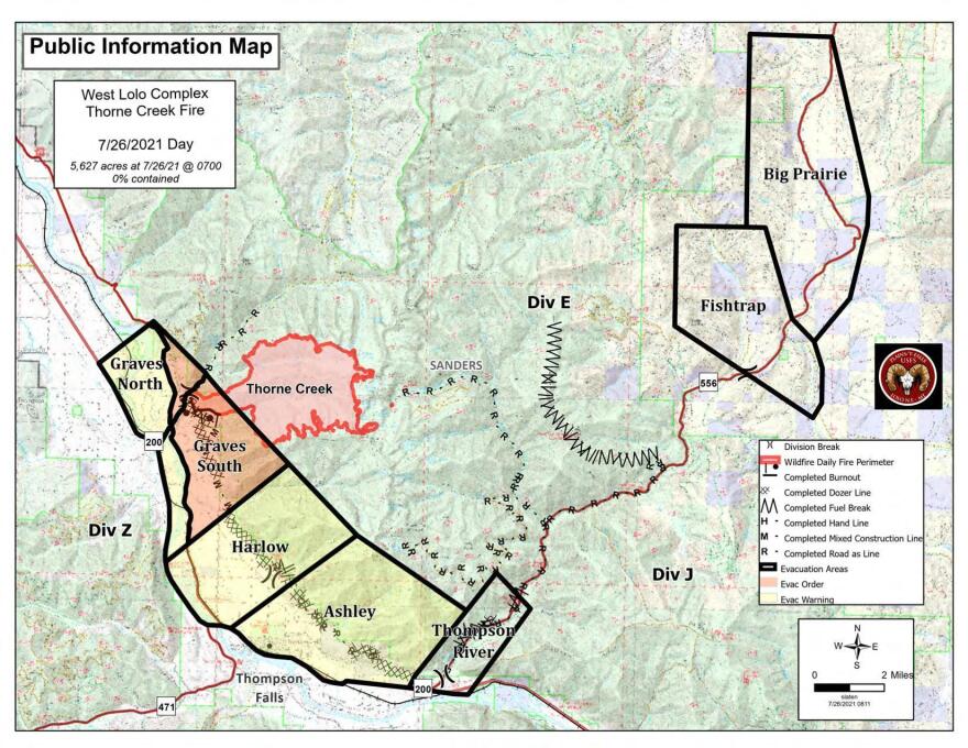
New pre-evacuation warnings for Harlow and Ashley areas went into effect Monday due to the Thorne Creek Fire burning more than 5,600 acres near Thompson Falls, according to a fire news release.
The Sanders County Sheriff issued evacuation orders over the weekend for an area described as “residences from Cougar Creek south to the intersection of Blue Slide Road and River View Lane, on the east side of Blue Slide Road in Graves North and South.” Sheriff’s deputies went door-to-door Sunday notifying residents there.
Firefighters have established points to minimize the chance of being flanked by the fire while they build and secure a fire line. Helicopters are dropping buckets of water on the charred land and supporting ground efforts, too. The blaze is 0 percent contained, according to Inciweb.

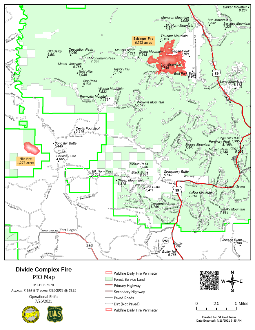
The Cascade County Sheriff’s Office also evacuated the Belt Park area due to the 5,200-acre Balsinger Fire. It’s part of the Divide Complex in the Helena-Lewis and Clark National Forest.

The fire caused a pre-evacuation order for the Belt Creek Ranger Station to Monarch and from west of Monarch to where Pilgrim Creek and Belt Creek meet.
Operations Section Chief Shawn Nagle says, “If you are residing in that area we’d really like people to evacuate. And again, that’s just for life safety at this point.”
The Woods Creek Fire, also burning in the Helena-Lewis and Clark National Forest, led to pre-evacuation warnings for several ranches near White Sulphur Springs. Evacuations have been issued for Atlanta Creek Road, the Thompson Guard Station and Gypsy Lake Campground, all of which are within the national forest.
The Woods Creek Fire grew roughly 10 times to about 2,700 acres Sunday, according to an infrared flight.
Air Quality Worsens
An air quality alert has been Issued for Beaverhead, Carbon, Gallatin, Lewis and Clark, Madison, Missoula, Park, Pondera, Powder River, Powell, Ravalli and Sweet Grass Counties, where air quality has reached, “unhealthy for sensitive groups” or “unhealthy." Air quality across the state ranges from "moderate" to "unhealthy", with the worst air quality concentrations occurring south of the I-90 corridor.
Smoke from wildfires is impacting most of the Northwestern U.S. due to the number of active fires in the region. When air quality is unhealthy, children and adults, and people who have a chronic condition such as respiratory disease or cardiovascular disease should avoid prolonged outdoor exertion. Exposure to wildfire pollutants can irritate lungs, cause inflammation, alter immune function and increase susceptibility to respiratory infections, including COVID-19. Populations known to be vulnerable to wildfire smoke exposure include: children, senior citizens, pregnant women, people with chronic health conditions such as heart or lung disease—including asthma and diabetes—and outdoor workers.
Learn how to make a low-cost home air filter.

Missing Firefighter Located
A firefighter who went missing Sunday night while working the 3,000-acre Granite Pass Complex Fire near the Montana/Idaho border was found early this morning uninjured and safe, according to a Missoula County Sheriff’s Facebook post.
Missoula County dispatch was notified of the missing firefighter around 7:30 p.m. Sunday after the person was late for a check-in. The Incident Management Team searched for the firefighter by ground and air. Missoula County Sheriff’s deputies, search and rescue officials, and Two Bear Air helped in the search.
The Granite Pass Complex Fire includes the Shotgun Fire, the Boulder Creek Fire, the BM Hill Fire and the Lolo Creek Fire. According to Inciweb, the blaze is more than 3,000 acres and 1% contained.


