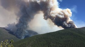
Fire teams across Montana today prepared for an unusual cold front that could stir up Montana's wildfires.
National Weather Service Hydrologist Ray Nickless says this weather system is typically called a "backdoor" cold front. Cold fronts typically enter Montana from the northwest.
“Well, this particular event, we’re seeing it drop out of Canada and then come across the continental divide from eastern Montana," Nickless says. "That’s why we call it the backdoor, cause it’s sneaking in from a different direction than what we normally see, especially this time of year.”
So, what's this have to do with Montana's wildfires? Forecasters say the system will likely bring some gusty northeasterly winds with it. Wind speeds will vary depending on location, but could range from 10 to 20 mph, gusting to 30 mph at times. That's why a Red Flag Warning is posted from 6 this evening through 6 a.m. Wednesday.
That warning basically covers the area stretching from Glacier National Park, along the Continental Divide, into Missoula and east to Drummond. That could potentially stoke every wildfire in its path. This is a dry cold front, meaning temperatures will moderate into the upper 80s to low 90s; just don't get your hopes up for any rain:
"Oh boy, moisture-wise, we just not seeing much,” Nickless says.


